


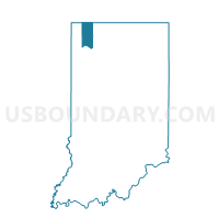
UNION 06, Porter County, Indiana
About
Outline

Summary
| Unique Area Identifier | 580085 |
| Name | UNION 06 |
| County | Porter County |
| State | Indiana |
| Area (square miles) | 0.91 |
| Land Area (square miles) | 0.90 |
| Water Area (square miles) | 0.01 |
| % of Land Area | 99.20 |
| % of Water Area | 0.80 |
| Latitude of the Internal Point | 41.51669100 |
| Longtitude of the Internal Point | -87.14343520 |
Maps


Graphs
Select a template below for downloading or customizing gragh for UNION 06, Porter County, Indiana


Neighbors
Neighoring Voting District (by Name) Neighboring Voting District on the Map
- PORTAGE 15, Porter County, IN
- PORTAGE 28, Porter County, IN
- PORTAGE 33, Porter County, IN
- UNION 01, Porter County, IN
- UNION 04, Porter County, IN